


⚡This is Equity Breakdown, where you will find short, no bullshit overviews of public companies! Join me in breaking down industries and companies that will become leaders embracing disruptive technologies and innovating change! Subscribe Now!
“The true currency of life is time…and we have all got a limited stock!” - Robert Harris
To all the Time Investors,
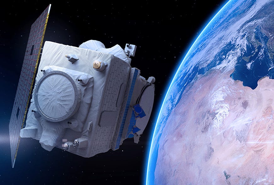
I was personally shocked at how much space impacted our daily lives. Our quality of life is convenient and well thanks to the infrastructure built-in space. Space-based communications, navigation, weather, remote sensing services, are all benefits. Every time we wake up and look at the weather, use our GPS, swipe our credit cards, and etc…we need to pause and look up and think about space. Today we will being our space journey by breaking down Maxar Technologies, "MAXR”, whose high-resolution images from space of the Suez Canal blockage by EverGreen were globally shared.
🔴Download Equity Breakdown Report
📖What is Maxar Technologies?
The pure-play space company is a combination of four companies that play a critical role on earth and space. Within this ecosystem, the company builds satellites, provides commercial radar, delivers commercial imagery with impeccable quality and capabilities, and provides geospatial data and analytics to the military, government agencies, and key commercial stakeholders. Maxar is a global player with ~4,300 employees, 20 strategic locations around the globe, and a strong partner with long-lasting relationships with key governments and commercial customers.
The company is divided into two core components:
Space Infrastructure: This segment includes space robotics, satellite hardware, satellite integration, system integration.
Communications and Earth observation satellites
Deep space exploration
On-orbit vehicles to service satellites
Robotics for space exploration and operations
Earth Intelligence: This segment includes the industry-leading geospatial data and analytics, analytics platform, and data services such as insights for military and commercial use.
Data for military intelligence purposes
Sensor and ground system that deliver geographical data
High-resolution, and electro-optical satellite imagery (Ever Green, Suez Canal blockage)
AI and Machine Learning at a global scale
📈Market Opportunity
The ~$368B space economy can be broken out into three categories:
$95B non-satellite industry which involves government space budgets, commercial human spaceflight, etc.
$123B satellite services spanning from telecommunications, remote sensing, and science-related activities
$132B ground equipment which involves network equipment and consumer products (radio, GPS)
$13B satellite manufacturing
$4.9B launch industry
Maxar believes that the earth observation market which encompasses satellite services, ground equipment, will be highly impacted by the need for data, solutions, and insights. AI-enabled data analytics is a common phrase that is consistent in Maxar’s communication. Sectors such as defense & intelligence, energy & natural resources, industrials, agriculture, finance, insurance, news and media, and weather are common beneficiaries of this market. Ultimately the quality of resolutions, accuracy, frequency, and delivery of the data will be a competitive selling point.
Additionally, the company believes satellite manufacturing will continue to evolve. Low earth orbit constellation satellites which are cheaper to launch and have less latency will expand in share. Large geostationary satellite technology will also advance which further the benefits of more coverage, enhanced telecom capacity, and advanced imagery. Overall, we can expect to see a combination of 25,000 active satellites in orbit from 2,600 satellites today.
The industry is expected to grow to $1 trillion by 2040 (CAGR 5%) driven by reusable rockets and more advanced lower-cost, high bandwidth satellites.
👨💻What are the Strategic Resources?
Product Portfolio: Designed and built 285 spacecraft with a combined service of 2,750 years of orbit service.
90 (1300-class platform) geostationary satellites in service that are placed 22,336 miles out in space directly above the Earth’s equator. The satellite is in place and takes a full 24 hours to circle the Earth.
The 1300 spacecraft is the world’s most popular platform of satellites due to cost and scalability
Earth observation satellites, direct broadcast satellites, two-way broadband satellites, digital audio radio satellites, digital multimedia satellites, meteorological satellites
In 2005, the company launched the first high throughput satellites that delivered applications such as consumer broadband and 4G/5G cellular backhaul.
The average cost for deploying a GEO satellite can range from $150-$200 million based on data from Euroconsult, an advisor specializing in satellite manufacturing
The company has operated a constellation of four satellites: GeoEye-1, WorldView-1, WorldView-2 and WorldView-3 that have a collection capacity of 1.4 billion square kilometers yearly
World View Legion LEO constellation satellites (6) will be launched this year.
This is a new generation of high-resolution earth imaging constellation satellites for government and commercial applications.
This will triple the companies high-resolution 37-year coverage and imaging capacity. Many areas will be captured 15 times in a single day to ensure timely and accurate data feeds for customers.
It will also benefit autonomous technology applications.
Robotics technologies are being embedded to create self-service spacecraft that can inspect, repair, tow, and fuel other spacecraft. The company wants to avoid losing high Capex assets or as they metaphorically put it “we don’t want to throw away a brand-new Ferrari after one tank of gas!”
The company has built robotic arms for five successful missions NASA Mars missions, including the Spirit, Opportunity, and Curiosity rovers as well as the Phoenix and Insight landers. The famous Perseverance rover is the sixth Maxar robotic arm.
OSAM-1 is being built in partnership with NASA, which will be a new generation of satellite spacecraft with robotic arms that can conduct “space surgery” on other satellites.
SPIDER is also being built which will signify on-orbit assembly of satellites with built-in robotic applications. This will reduce the demand to launch a fully assembled satellite spacecraft in the future since assembly can occur in space.
SAMPLR will be the first robotic arm to the moon in 50 years as part of NASA’s Artemis program along with SpaceX. The mission will aim to send the first woman and the next man on the moon by 2024.
ImageLibrary is a collection of 125 petabytes of high-resolution imagery from satellites.
Provide critical and accurate data for military mission planning, crop management, oil and gas exploration, and infrastructure management.
Maxar offers subscription services such as SecureWatch— which provides customers with extensive imagery and geospatial intelligence platform and addresses a broad spectrum of uses.
The company provides regular updates of images to over 6,000 major cities around the world.
3D mapping and modeling capabilities
Developing Resources:
Maxar Technologies holds 22 patents and 8 U.S. patent applications pending based on third-party sources. In 2020, the company spent $226 million and $22 million on Earth Intelligence and Space Infrastructure Capex. This represents about 15% of revenue. The company also received $93 million in tax credits for research and development activities and had an additional $15 million dedicated to pure research and development activities regarding new technologies in the space.
Customer Landscape + Partnerships:
Government
U.S. government is the largest customer for Earth Intelligence segment. They drive around 72% of the revenue generated from the Earth Intelligence segment and 40% from the space infrastructure segment.
NASA Contracts for missions to the moon, asteroids, and MARS.
U.S. National Geospatial-Intelligence Agency (“NGA”) contract that delivers land cover classifications
U.S. Department of Homeland Security contract to develop an analytics system that tracks the behavior of vehicles in many strategic locations
Renewal of five key contracts with international defense and intelligence customers for access to the current satellite constellations amounting to $120 million.
U.S. Army Geospatial Center contract to deliver geospatial intelligence for tactical ground purposes.
U.S. Space Force contract to build out data processing applications
U.S. Army’s One World Terrain project to build out 3D products
Commercial players impact about 28% of the revenue from the Earth Intelligence Segment and about 60% from the Space Infrastructure segment of the business:
Amazon, Google, Palantir, Uber, and GM are but a few customers.
Business Model and Growth Strategies:
Maxar’s revenue is highly dependent on multi-year contracts established with the U.S. Government, Civil Agencies, and commercial customers. Specifically for the Earth intelligence segment revenue is generated from the imagery and geospatial service contracts. As satellite capacity is made for the customer revenue is recognized for that period. Examples of revenue strategies are below:
The EnhancedView Contract, a multi-year contract, from the U.S. Government is around ~$300million and has been extended to 2023.
SecureWatch Program generates subscription revenue for access to high-resolution imagery for on-the-ground intelligence.
Rapid Access Program which allows customers to access satellite constellations, while the company manages and owns the ground infrastructure
DAP (Direct Access Program): The company sells ground system infrastructure to customers to allow them to download data and imagery from the constellation satellites Maxar manages.
As of 2020, Maxar generates 63% of the revenue from the Earth Intelligence segment and 37% from the Space Infrastructure segment.
2020A: Revenue: $1.7B | 2022E: Revenue: $1.8B – 3.0% CAGR
$1.9 billion in backlog driven by new contracts with civil agencies involving new space missions.
2020E: EBITDA: $422M (24.5%) | 2022E: EBITDA: $541M (29.6%) – 13.2% CAGR
2020E: FCF: $-65M | 2023E: FCF: $325M
Market Cap $2.7B | Enterprise Value: $5.4B
The company plans to continue accelerating growth through the following initiatives:
Acquisitions: In Q1 of 2020, the company finalized its acquisition of Vricon, a company that is a global leader in 3D data from satellites for defense and intelligence applications (military simulations, and precision-guided missiles).
Earth Intelligence Expansion: Leverage 3D data and 3D capabilities to expand relationships with U.S. government and commercial customers. This will be accelerated by the launch of the WorldView Legion constellations, Vricon acquisition, and data platforms that have AI/ML capabilities. Maxar needs to service the demand for geospatial intelligence data.
Space Infrastructure Expansion: Maxar will expand the manufacturing of LEO satellites that are more cost-effective for commercial purposes. They are also heavily investing in space robotics, solar electric propulsion, and spacecraft buses to support critical missions in the next three to five years with strategic partners such as NASA and SpaceX.
Commercial Markets: There is a high demand for autonomous applications, wireless network planning, voice and data communications, video distribution, broadband, and resource and logistics planning as the world becomes more digital. Maxar’s technology applications will focus on provided such services.
💪Key Strategic Moats
Technology: Satellite constellations that will deliver 30-cm capacity and will be able to get to any point on the planet. The company also has designed space robots for critical missions to the moon and Mars. Additionally, with their most recent acquisition, 3D mapping and elevation services will become a differentiator. To top it off, Maxar has over 125 petabytes of data collected over a 20-year history.
Team: The majority of the management team is composed of experienced leaders from DigitalGlobe, a company that built the industry largest library of high-resolution satellite imagery. There is a high demand for satellite-generated data and insights for military and commercial purposes. The team is operationally focused to ensure that the most profitable segments of the business in this case geospatial data and analytics have all the dedicated resources to grow.
State-Granted: The U.S. Government heavily depends on the Earth Intelligence services provided by Maxar. The EnhancedView program is a 20-year program that is utilized to support data and analytics for 400k users in the government and intelligence community. The company is also positioned well with defense strategy across cyber and space, missile defense, and autonomous systems.
Brand: The company has delivered over 60 years of innovation and reliability in space with 90 geostationary satellites, 285 spacecraft, and 3.5B square kilometers of earth imagery (~24x Earth’s total landmass).
⚠️Key Critical Risks
Competition: The company faces heavy competition with companies like the Boeing Company, Lockheed Martin Corporation, Northrop Grumman Corporation, and Thales S.A. which are much larger in terms of revenue and market value. The company needs to also ensure that they are leaders in the emergence of new remote imaging technologies or the continued demand of low-cost imaging satellites.
Operational Risks: Satellites are capital and time-intensive. Construction and launch delays, launch failures, and damages can severely impact revenue for months to come. In 2019, Maxar lost the WorldView-4 satellite impacting revenue.
Revenue Risk: Revenue from U.S. Government agencies is mainly generated from the EnhancedView Contract to provide image-tasking capabilities. Any lag in service could result in immediate termination of the contract.
Manufacturing Risk: Maxar has highlighted that they rely on a single vendor or a limited number of vendors to provide certain key products for manufacturing satellites. This reliance can put them at risk for pricing pressures as the demand for satellites increases with the expansion of the space economy. Additionally, aluminum and titanium are critical raw materials that are necessary for the productions of the spacecraft.
Debt Risk: The execution of revenue strategies such as launching the satellite constellations and the various services for government agencies require a lot of capital. As a result, the company has highlighted that they have a significant amount of debt amounting to $2.1B (4x EBITDA) as of 2020.
🧬Team DNA and Vision
Key Leaders:
Daniel L. Jablonsky - Chairman and CEO: President of DigitalGlobe since October 2017, which offered high-resolution satellite imagery. Jablonsky has a strong academic and professional background in law and served in U.S. Navy as a surface warfare officer and nuclear engineer.
Dr. Walter Scott – Chief Technology Officer: Previous founder and Chief Technology Officer of DigitalGlobe. He was responsible for the platform, business units, and space system acquisitions.
Tony Frazier – Global Field Operations: He currently leads business development and service delivery activities. Prior, served as President of Radiant Solutions, and General Manager of DigitalGlobe’s services business.
Jeff Culwell - Chief Product Officer: Prior served as DigitalGlobe’s SVP and Operations, delivering low latency imagery from direct access to satellites. His responsibility ensured satellite constellations, remote ground terminals, and customer installations.
Paul Estey – Space Programs Delivery: His role ensures the creation of advanced satellites and spacecraft systems for customers. Estey has decades of experience in the space business since 1997 serving various engineering and leadership roles.
🤯Key Insights for Time Investors:
The satellite consists of many small electronic, mechanical, and thermal systems that have to undergo a lot of tests and endure space-like conditions. A satellite takes about four years if it is new or about one to two years if it’s an existing satellite to manufacture or repair and prepare for launch. On launch day after years of work the fate of the satellite depends on an equivalent 4 million pounds of TNT and metaphorically speaking one button. Ultimately, the asset that is meant to generate revenue is very delicate and very risky.
The space economy is expanding and with many players entering the market, investors are looking for the next opportunities. While this is an intensive capital business the players that will ultimately succeed will have top engineering teams, strong relationships with the U.S. government and civil agencies, and the ability to build business models that generate revenue.
To put this into perspective the U.S. Government and its agencies (National Security Space, Intelligence Agencies, NASA) have allocated a total budget of $101 billion for 2021. This represents about a third of the total space economy industry. As a result, while commercial use is expanding the relationships between the government and its agencies are critical for economical success.
When highlighting the risks, Maxar during the year 2019 restructured their satellite service business to preserve and enhance it. The GEO satellites are very capital intensive and the failure of their WorldView-4 satellite drove additional financial risk. Ultimately with new leadership from their merger with DigitalGlobe in 2017, the company will focus on LEO constellation satellites. All eyes are on the launch of their new WorldView Legion constellations in 2021. This monumental step will be pivotal to the company’s success in the next years. With the large debt, the company has accumulated any failure at this point could be detrimental for the company and for investors.
Ultimately, as the demand for data increases and launch costs decrease, Maxar needs to continue to be a leader in providing data with AI/ML capabilities towards strategic customers and ensure they are embracing leading technologies in their satellites.
Additionally, the company is diversifying its revenues beyond earth intelligence and satellite manufacturing towards space robotics. They are key partners with important missions like NASA’s Artemis program to the moon, and NASA’s Perseverance Mars mission that happened earlier this year.
As an investor, I would like to see Maxar Technologies diversify its revenue model to remove dependence from long-term contracts and build services that allow recurring subscriptions with the delivery of insightful data and the use of its space infrastructure products. As a $2 billion dollar market cap, the company has $25 billion in pipeline activity across these next five years. If the company can achieve its key milestone launch this year, preserve its dominance in satellite technology, data intelligence, and maintain critical strategic partnerships it could put the company on the right path.
Stay incurably curious!
-Igli G. Laçi
If you like the content please make sure to share this newsletter, share this post, follow me on Twitter, and/or subscribe (if you have not already)!
Additional resources and sources I used for all the Time Investors (Leeeetttsss Gooooooo!!!)
Disclaimer: The companies mentioned in my newsletter are not investment advice. This is simply information researched to help you learn about industries and various public companies


Maxar Technologies ($MAXR) Breakdown